

campground Map
Save this location for offline use before your trip. For best results, create/open a trip from this page and download the same area.
Nearby Trails
About this site
S. Highway 14) near the Burgess Overlook and Woodrock areas at an elevation of 8,400 feet. The Bighorn National Forest, where the campground is located, offers a wide variety of activities, including hiking, fishing, scenic driving and a number of historic sites.
com Recreation Off-road vehicle trails, scenic jeep roads, hiking, fishing and canoeing are available in the surrounding area. Diverse hikes vary from loop trails to treks along creeks and over mountain peaks; many trails access the Cloud Peak Wilderness. Nearby Sibley Lake is open to non-motorized craft and offers an accessible fishing dock on the shoreline.
Anglers fish for rainbow, brown and brook trout. Facilities The campground offers several single-family sites each equipped with a picnic table and campfire ring with grill. Accessible vault toilets, drinking water and trash collection are provided.
Natural Features The campground is situated on the banks of the South Tongue River in the Bighorn Mountains, where craggy granite peaks rise over 13,000 feet above sea level. A forest of lodgepole pine covers the area, creating excellent wildlife habitat. Contact Info For facility specific information, please call (307) 431-7446.
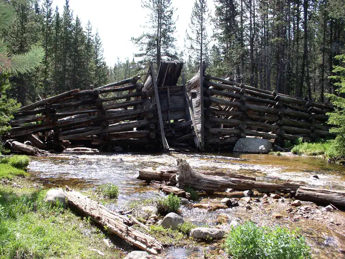
Nearby Attractions Decades ago, many trees in the Tie Flume area were cut for railroad ties. Remnants of the old splash dams and tie flumes are found on the river around the campground. Shell Falls Visitor Center, at the overlook of Shell Falls, is about 18 miles southwest.
This center offers interpretive trails, scenic views, and educational displays about natural features such as flora and fauna and area history.
📞 406-587-9054
Reviews
No reviews yet.
Reviews and photos are added by members after completing a trip here. Plan a trip to be the first!
Campground data provided by Recreation.gov · Updated Apr 2026
Reserve at Recreation.gov →