

Curtis Gulch Campground
campground Map
Save this location for offline use before your trip. For best results, create/open a trip from this page and download the same area.
About this site
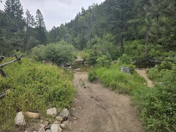
Overview Curtis Gulch Campground sits at an elevation of 6,640 feet, at the end of the long and scenic LaBonte Canyon. There are 6 sites along a bend in the creek with picnic tables, fire rings, pedestal grills, a vault toilet, pump water well, and trash bins. Recreation Recreation The canyon bottom is about 6,700 feet in elevation and has granite rock formations for technical rock climbing and photography.
LaBonte Creek runs through the entire length of the canyon and offers anglers many opportunities to catch the rainbow trout stocked annually by the WGFD. For OHV riding, the LaBonte Canyon Trail starts at the back of the campground, and The Big Bear Trail System is located just 1/4 mile up the canyon. Both are 50” or less OHV trails but are also commonly used for hiking, biking, and horseback riding.
FSRD #610, Devil's Pass, and the South Fork LaBonte Trails to the south offer additional opportunities for adventure. The Curtis Gulch Trail is non-motorized and starts at the trail parking area just outside the campground. The Laramie Peak Unit of the Medicine Bow National Forest is located in Central Wyoming.
The Douglas Ranger District manages the Laramie Peak and Thunder Basin National Grasslands. Year-round recreation uses include hiking, fishing, hunting, climbing, OHV riding, dirt bike riding, camping, biking, and horseback trail riding. Primary access across the district is by I-25 and Highway 59.
📞 307-358-4690
Reviews
No reviews yet.
Reviews and photos are added by members after completing a trip here. Plan a trip to be the first!
Active Trips
0No active trips at Curtis Gulch Campground right now.
Start the first trip hereCampground data provided by Recreation.gov · Updated Apr 2026
Reserve at Recreation.gov →