

Bogoslof Wilderness
campground Map
Save this location for offline use before your trip. For best results, create/open a trip from this page and download the same area.
About this site
The Bogoslof Wilderness now contains a total of 175 acres and is managed by the Fish & Wildlife Service. All of the Wilderness is in the state of Alaska. In 1970 the Bogoslof Wilderness became part of the now over 110 million acre National Wilderness Preservation System.
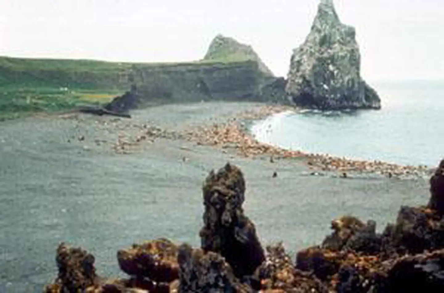
Aleuts believed that they heard the "voice of God" (bogoslof) as a fiery eruption lifted Bogoslof Island from the cold Bering Sea around 1796. Bogoslof and little Fire Island (about five acres) became Wilderness in 1970 and a subunit of the Aleutian Islands Unit of the Alaska Maritime National Wildlife Refuge in 1980. An active volcanic island, Bogoslof has undergone change as recently as 1993.
A single rugged spire, Castle Rock, stands above the island's rocky beaches and black lava. Vegetation on this domed and treeless isle is typical of the Aleutians: grasses, sedges, heath. As many as 90,000 murres, kittiwakes, puffins, and gulls nest here.
A rookery of fur seals has grown in size, while a sea lion rookery that peaked with about 5,000 individuals has shrunk.
📞 907-235-6546
Reviews
No reviews yet.
Reviews and photos are added by members after completing a trip here. Plan a trip to be the first!
Active Trips
0No active trips at Bogoslof Wilderness right now.
Start the first trip hereCampground data provided by Recreation.gov · Updated Apr 2026
Reserve at Recreation.gov →