Logistics at a Glance
| Item | Details |
|---|
| Entry fee | $35/vehicle (7-day) — America the Beautiful Pass accepted |
| Timed-entry permit | Required for Bear Lake Corridor (May–October, 5am–6pm) and park-wide entry (peak summer). Purchase at recreation.gov — opens 24 hours to 7 days before. Check current requirement at nps.gov/romo before trip. |
| Longs Peak | The park's only 14er. No technical permit required for the Keyhole Route, but the NPS strongly recommends registering at the Longs Peak Trailhead register. This is a Class 3 scramble — see section below. |
| Camping | Moraine Park, Glacier Basin, Aspenglen, Timber Creek, and Longs Peak campgrounds all reservable at recreation.gov. Moraine Park and Glacier Basin are most in-demand. |
| Trail Ridge Road | Highest continuous paved road in the US (12,183 ft peak). Open approximately Memorial Day through mid-October, dependent on snowfall. Check status at nps.gov/romo. |
| Bear Lake shuttle | Park and ride at the Estes Park Visitor Center or Bear Lake Road park-and-ride; free shuttle to Bear Lake Corridor trailheads. Running in peak season. |
| Cell coverage | Limited to good on Trail Ridge Road and some peaks; poor on east-side trails and Bear Lake area. Download maps offline. |
| Nearest hospital | Estes Park Health (Estes Park), UCHealth Medical Center of the Rockies (Loveland, 45 min) |
Day-by-Day Schedule
Day 1: Bear Lake Corridor
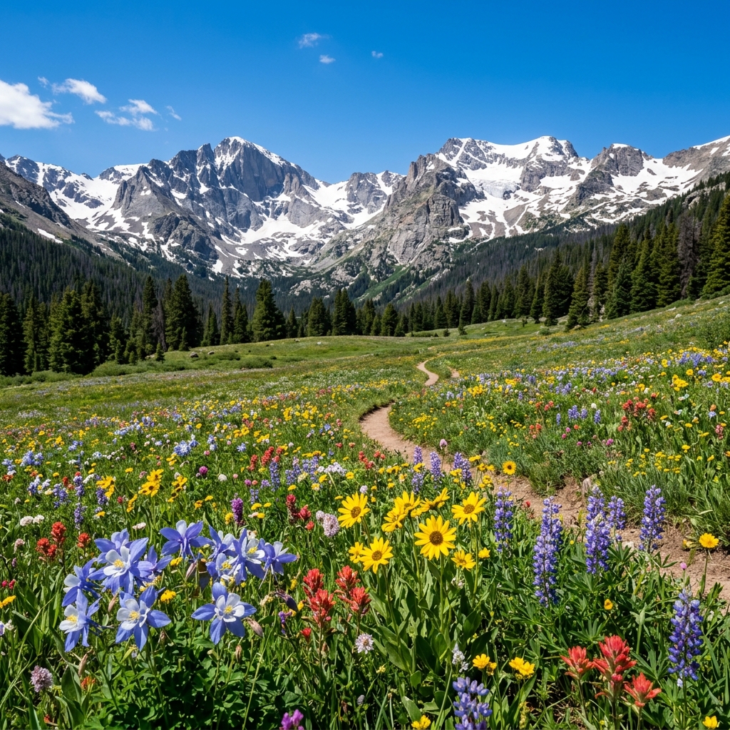
The Bear Lake area is RMNP's iconic entry point — a series of alpine lakes connected by well-maintained trails.
Start: Bear Lake (9,475 ft)
0.5-mile loop around Bear Lake is the base — flat, paved, accessible. Does not require shuttle.
Nymph Lake → Dream Lake → Emerald Lake Loop
- 3.6 miles round trip from Bear Lake trailhead
- Nymph Lake: 0.5 miles from trailhead; lily pads in summer, reflections
- Dream Lake: 1.1 miles; Hallett Peak reflection across the lake — the classic RMNP photo
- Emerald Lake: 1.8 miles; end of maintained trail; dramatic cirque walls
- Allow 3 hours; trail is well-maintained but gains 605 ft from Bear Lake to Emerald Lake
Afternoon — Lake Haiyaha side trail:
From Dream Lake junction, branch to Lake Haiyaha (2.1 miles from Bear Lake). Less crowded. Excellent bouldering at the shore.
Evening: Return to camp. Moraine Park campground hosts elk viewing in meadows during evening hours — particularly during September/October rut.
Day 2: Trail Ridge Road + Kawuneeche Valley
Trail Ridge Road drive (weather permitting):
- Open approximately 10am–5pm at Visitor Centers along the route in shoulder season; earlier in summer
- Pull-outs and short walks:
- Many Parks Curve (9,620 ft): broad panorama of the Front Range below
- Forest Canyon Overlook (11,716 ft): canyon system view from tundra
- Rock Cut (12,110 ft): Park Your Car, Walk the Tundra Communities Trail (0.5 mile, paved). At this elevation, the wind is constant and temperature is 30°F colder than Estes Park. Dress accordingly.
- Alpine Visitor Center (11,796 ft): museum, restrooms, café (seasonal)
Kawuneeche Valley (West Side)
After crossing Trail Ridge Road, the park's west side is dramatically different — no alpine rock, no crowds, dense forest, Colorado River headwaters meadows.
- Colorado River Trail: 1.7 miles to the Lulu City site (an 1880s silver mining ghost town site); flat, forested, quiet
- Kawuneeche gets only ~5% of RMNP visitor traffic. Use this.
Return via Trail Ridge Road: Sunset from Forest Canyon Overlook or Rock Cut if conditions allow.
Day 3: Longs Peak (14,259 ft) — Know What You're Getting Into
This is a full-day, strenuous, Class 3 alpine scramble. Do not take it lightly.
| Factor | Reality |
|---|
| Distance | 14.2 miles round trip |
| Elevation gain | 5,100 ft |
| Time | 10–15 hours |
| Technical difficulty | Class 3 — requires using hands on rock. No technical gear, but significant exposure above 13,000 ft |
| Start time | 3:00–4:00 AM mandatory. Summit before noon to avoid afternoon thunderstorms. |
| Season | Keyhole Route is clear approximately mid-July through September. Snow and ice require crampons and ice axe before and after this window. |
| Recommended experience | At least one 14er summit + multi-mile hike with 3,000+ ft gain |
Route Overview:
- Longs Peak Trailhead (9,405 ft) → Chasm Lake junction → The Boulderfield: 6 miles on maintained trail, gaining 3,500 ft
- The Keyhole (13,150 ft): A distinctive rock arch. You pass through it to the west face.
- The Ledges: Exposed traverse along the west face; follow yellow/red painted targets (bulls-eyes) on rock
- The Trough: A steep gully climb of 500 ft — loose rock and significant exposure
- The Narrows: A narrow ledge traverse
- The Homestretch: Final 300 ft of Class 3 slab to the summit
Turnaround criteria:
- Any visible lightning. The exposed upper mountain has killed climbers in afternoon storms. If lightning threatens, turnaround is mandatory, no exceptions.
- Noon rule: If you have not reached the Keyhole by 10am (or 9am in storm-prone conditions), turn around.
- Conditions above treeline: High winds (40+ mph), significant cloud buildup, ice on rock.
Alternative Day 3 option (if Longs is too advanced or weather prohibits):
- Chasm Lake (8.4 miles RT, 2,420 ft gain): The base of the Diamond face of Longs Peak. Alpine lake directly below massive cliffs. No technical difficulty. Stunning destination in its own right.
Altitude Acclimatization
At 8,000–14,000 ft, altitude affects everyone. The 24–48 hour rule: spend your first night at moderate altitude and ascend gradually. Estes Park (7,522 ft) is a good acclimatization base.
Signs requiring descent: Severe headache unresponsive to ibuprofen, vomiting, loss of coordination, confusion. These are signs of altitude sickness — descend immediately.
Where to Sleep
| Option | Details |
|---|
| Moraine Park Campground | 244 sites; year-round; most popular camp in RMNP; reservations required |
| Glacier Basin Campground | 150 sites; summer only; closest to Bear Lake Corridor |
| Aspenglen Campground | 54 sites; near Fall River entrance; less congested |
| Longs Peak Campground | 30 tent-only sites; walk-in; closest to Longs Peak trailhead; no hookups |
| Estes Park lodging | Hotels and vacation rentals 2–5 miles from park entrance; excellent base |
What to Pack (RMNP-Specific)
- Layers for alpine: Temperature swings from 80°F at Bear Lake to 40°F at Rock Cut on Trail Ridge. A hardshell and warm mid layer are not optional.
- Gloves and beanie: Year-round for Trail Ridge and Longs Peak
- Trekking poles: Significant benefit on Longs Peak descent on The Trough
- Sun protection: Altitude means UV increases ~4% per 1,000 ft. SPF 50 minimum above 10,000 ft.
- Lightning protocol: When thunder is heard, descend immediately from any exposed ridge or summit
Common Mistakes at RMNP
- Starting Longs Peak after 4am. Late starters routinely get caught in afternoon lightning. The mountain kills a hiker via lightning most years.
- Arriving at Bear Lake without a timed-entry reservation. The Bear Lake corridor requires it in peak season. You will be turned away.
- Underestimating altitude effects. Visitors from sea level often feel fine for the first few hours and terrible on day 2. Plan a light Day 1 regardless.
- Starting Trail Ridge Road late in the day. Weather on Trail Ridge deteriorates rapidly in the afternoon — strong winds and afternoon storms are common.
- Not having weather data for Longs Peak. Check mountain-forecast.com or similar for 14er-specific weather, not just Estes Park forecast.
Quick-Reference Card
| Item | Info |
|---|
| Park entry (car) | $35/vehicle, 7-day |
| Timed-entry permit | recreation.gov (peak season) |
| Campsite reservations | recreation.gov, 6 months ahead |
| Trail Ridge Road status | nps.gov/romo |
| Longs Peak conditions | 14ers.com/peak/longs_peak |
| RMNP Backcountry Office | (970) 586-1225 |
| Estes Park Health (ER) | (970) 586-2317 |
| Emergency | 911 |